Portfolio / New Heights Inc.

Practical thinking. See it at work.

Working software, not mockups. Each of these opens in your browser and runs on real or clearly labelled sample data.

Real estate · Web & software

Chicagoland Property Intelligence

A deal finder for Chicago agents and investors. 83,935 parcels across eight Northwest Side community areas on one map, with assessments, 59,651 recorded sales and city code signals. A screener ranks the widest gaps between what a property is assessed at and what nearby homes sell for, each parcel opens a full card with comparable sales, and a leads feed surfaces foreclosure deeds, bank-owned resales and estate transfers.

The screen

  1. All eight community areas
  2. Single family and 2 to 6 flats
  3. Sold in the last 3 years
  4. Assessor value up to $500k

2,305 matching parcels

PIN 16-02-301-026-0000Humboldt Park

1101 N Harding Ave

Assessor value, 2026
$220,000
Value hint from nearby sales (estimate)
$368,000
Last sale, April 2025
$68,400

First result sorted by lowest last-sale price per sq ft: $42/sq ft for a 1,632 sq ft house built in 1910. The value hint is the median price per sq ft of the 25 nearest market sales times its size; it knows nothing about condition.

Real record from the demo: Cook County Assessor open data, tax year 2026.
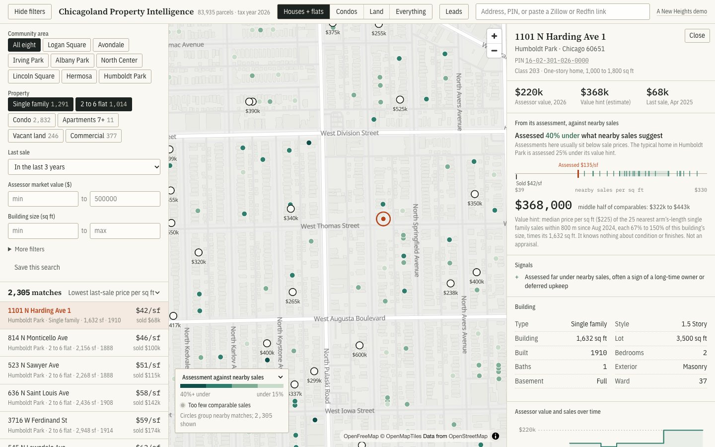
The deal finder map of Humboldt Park with a parcel card open for 1101 N Harding Ave

Weather & claims · Web & software

Chicagoland Hail Atlas

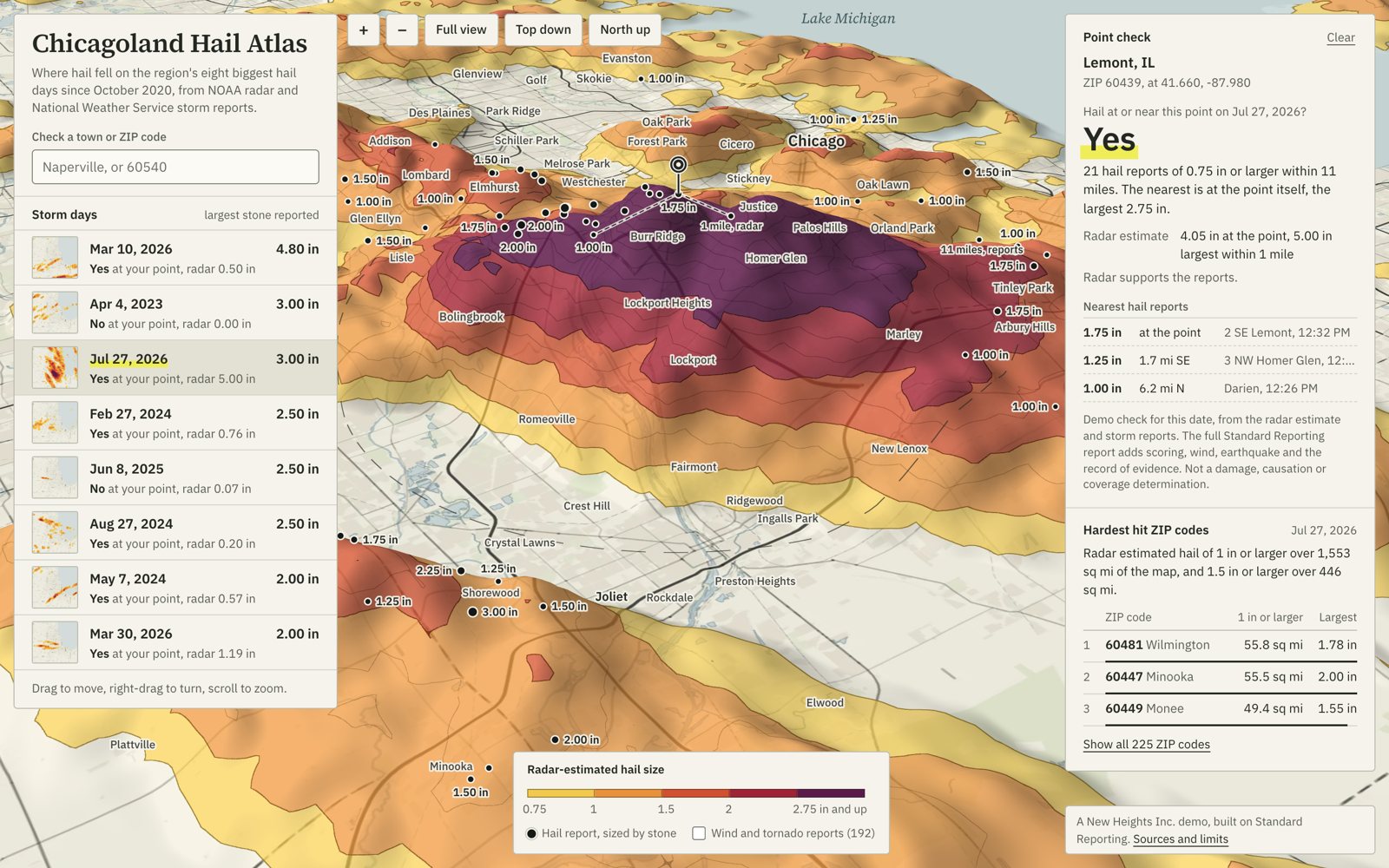
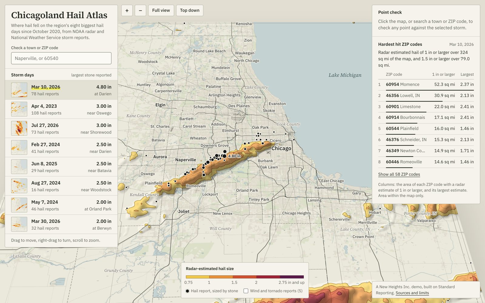
Where hail fell across the Chicago region on its eight biggest hail days since October 2020. Each storm's NOAA radar estimate is raised as 3D relief over the map, with every National Weather Service storm report pinned on it and a ranking of the hardest hit ZIP codes. Click any point for the answer a claim turns on: hail at or near here on that date, yes or no. Built on Standard Reporting, the weather verification engine for insurance claims.

The July 27, 2026 hail swath over the south-west suburbs drawn as 3D relief, with a point check open for Lemont 8 storm daysPoint checkHardest hit ZIPs

Visualization · Web & software

Chicago in 3D

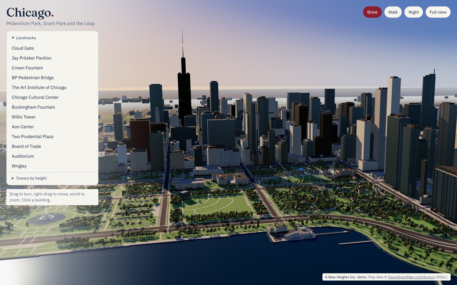
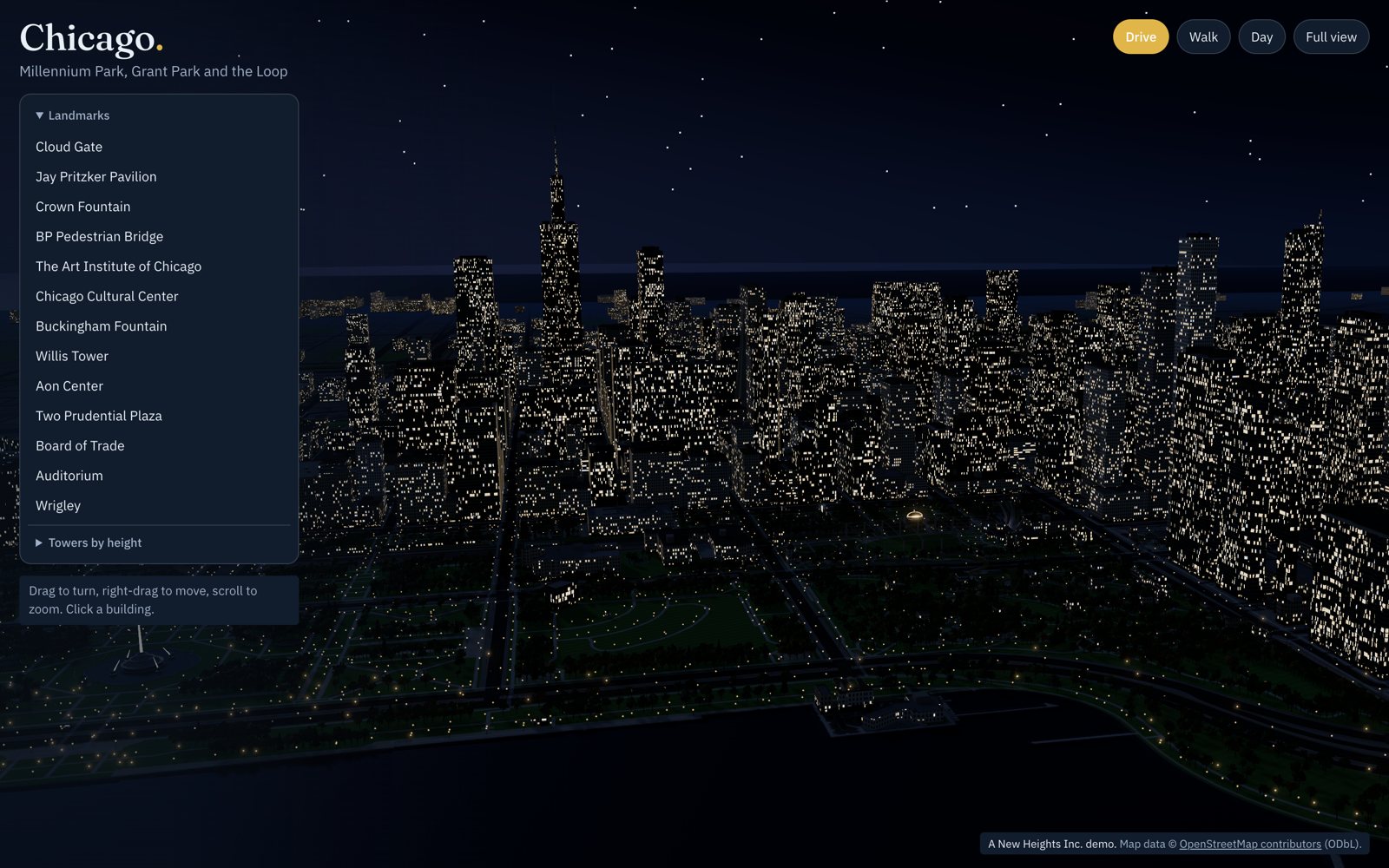
Millennium Park, Grant Park and the Loop, from Willis Tower to Monroe Harbor, built in the browser from OpenStreetMap and real elevation data. Around 1,200 buildings at their mapped heights, with Cloud Gate, Pritzker Pavilion, Crown Fountain, Buckingham Fountain and the L hand-modelled. Orbit it, drive it or walk it, switch to night, and click any building to fly there. A way for developers, brokers, venues and visitors to show a place before anyone sets foot in it.

3D model of the Chicago Loop skyline above Grant Park and Lake Michigan OrbitDriveWalkNight

Technology & operations

Tools for the people behind the work.

Explore working demos of the dispatch map, interview library, directory, and calendar booking system, plus a static onboarding preview.

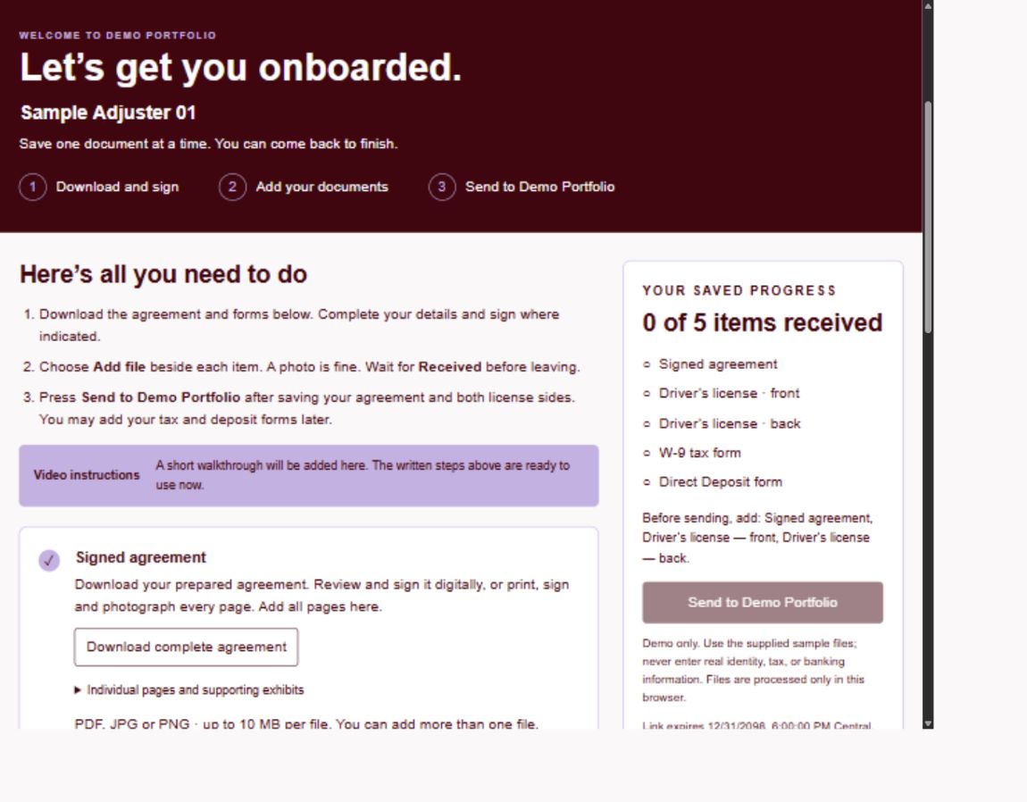
Onboarding interface preview with document checklist and completion tracking
  1. 01Dispatch mapWorking demo
  2. 02Interview libraryWorking demo
  3. 03OnboardingTechnical overview
  4. 04DirectoryWorking demo
  5. 05Calendar & bookingWorking demo

Your next chapter starts with a conversation.

Where do you want to go next?

Let's talk about it
Admin@newhts.com

Marketing. Development. Consulting.
One thoughtful partner.